Haena Beach on Kauai, Hawaii
Hotels in this story
Price Dates
The Westin Princeville Ocean Resort Villas
Hanalei Colony Resort
To better understand the geography of Kauai‘s north shore, it helps to first know a bit of Hawaii’s history. The traditional Hawaiian division of land is called an Ahupua’a, an area that extended from high in the mountains, along the waterways as they descended through valleys and onto the coastal plains, and out to the protective reefs (valuable fishing areas). The boundaries were marked by Ahu (stone cairns) upon which the Maka’ainana (people living on the land) would place a Pua’a (pig or other form of tribute) for the local Chief or Konohiki (administrators). This system ensured a shared use of the land and its natural resources, as well as the necessary Kapu (restrictions) to ensure the environment’s sustainability.
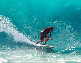
Haena is the most beautiful and unique of the seven Ahupua’a on Kauai’s north shore (it’s the one farthest to the west) in the moku (or county) of Halele’a. Normally, a moku was named in reference to its geographic location on the island — such as Ko’olau (windward), Kona (southwestern), Puna (eastern), etc. — but Halele’a is different. For its plentiful sources of fresh water, natural resources, protected reefs, and, of course, its fantastic surf, its name actually means the “House of Joy” (hale means house and le’a means joy). As for Haena, its name translates to “the intense breath of the sun,” a name that feels especially apt on Ke’e Beach, the birthplace of the Hula dance and an area that has inspired many Hawaiian cultural tales, in which gods intervene with human cultural and historical figures.
Terraced fields in the Limahuli Valley of Kauai, Hawaii
[Flickr/Librarian In Black]
Limahuli Valley is the most prominent area in Haena. Its watershed flows from the Alakai Swamp, the wettest spot on the planet, down through 2000-foot ridges, an 800-foot waterfall, through a rainforest nature preserve, into the Kalo Loi (pronounced Ka-lo Lo-ee) at Limahuli Gardens, and finally out to sea. At Kalo Loi, Hawaiians have been cultivating taro (a staple vegetable in the Hawaiian diet even today) for hundreds of years. Tubers of taro can be cooked in an imu (earthen oven) for a few hours and then eaten directly, dried as ‘ao (taro chips) for longer seas voyages, or pounded into a pudding called poi (something most visitors will try at least once). In fact, Limahuli means “turning hands,” which describes the process ancient Hawaiians used to carefully fit lava stones together to create agricultural terraces for the cultivation of taro.
Stay on the north shore at either Westin Princeville or Hanalei Colony resorts.
– Brian Ross of Photo Safari Hawaii
Top photo courtesy of pdxjeff’s photostream
PR: wait…
I: wait…
LD: wait…
I: wait…
wait…
Rank: wait…
Traffic: wait…
Price: wait…
C: wait…
 Publish for free


 zpostcode
 Recruit
 weather
 mreligion
 Yellowpages
 sport
sport constellation
 shopping
 name
name game
game directory
 literature
 Word
Word tour
tour furnish
 Lottery
 tftnews
 lyrics
 News
News digital
 car
car dir
dir Edu
Edu Finance


