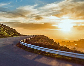
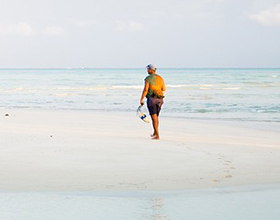
Uttarakhand is a trekker’s paradise with numerous hiking trails cutting through forests, meadows, mountains, streams and clearings. The Ranthan Top trek is fast becoming a fan favourite due to its stunning scenery and the panoramic views of Nanda Devi and Sunanda Dev in the Kumaon Himalayas.
This moderately difficult trek will reach altitudes of 3,927m and covers a total distance of 36km. Here’s our itinerary on what to expect from traversing the Ranthan Top on your own or with a certified tour operator.
Day 1: Kathgodam To Gogina

Alight at the Kathgodam (KGM) Railway Station and commence a 228km drive to Gogina near Munsiyari. The journey will take anywhere from eight to nine hours and will pass through well-known towns like Nainital, Almora and Binsar. Travellers will be enchanted by the beauty of the rivers and mountains with rows and rows of pine trees acting as sentinels.
Make sure to rest well and recharge as your trek begins early the following day.
Day 2: Gogina To Namik Campsite

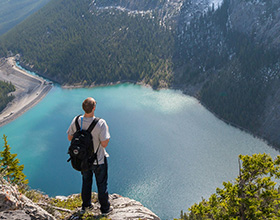
Today's six hour trek will begin from Gogina village. The hike has steep and winding paths so trekkers have to be careful of their footing. On your way you will see views of the Ramganga River. The breathtaking views of the valley below and the cave-like formations on the mountainside are striking to behold.
After crossing the Ringal forest you will see signs of Namik village. Make your way to the campsite 1.5km away and have a chat with the residents to learn about their life as you wind down for the day. Namik Glacier will be visible from this vantage point.
Day 3: Namik Campsite To Bajimanian Kharak

The path to Bajimanian Kharak, also known as Baji Kharak (kharak means clearing), runs through several forested areas and open spaces. Oaks, maples and rhododendrons greet visitors after crossing their first kharak, particularly in the spring when the fields are litterd with blooming flowers.
After a break and a chance to refill water supplies from a stream, you will ascend to the Raj Gailgadi kharak. Shepherd’s huts and a revered oak tree will grace your path as you walk to Parava Thor. Once you reach the Bajimanian Kharak campsite take in the charming views of the setting sun and the sound of chirping birds.
Day 4: Bajimanian Kharak To Chophu Campsite Via Thal Tok

You will notice the trail gradually curves back towards Munsiyari and will reached a fork after a kilometre or so. The straight path leads to the Sursungri Khal Pass. The left path descends slightly before levelling out on a ledge, from where you can admire the expansive Thala Kharak grassland. Continue on this path and you will see Thal Tok, a U-shaped depression that marks the route to the Chophu campsite.
The ascent from Thal Tok to the Chophu campsite involves a challenging climb along a winding trail. One of the attractive features of this location is the presence of a nearby water source.
Day 5: Chophu Campsite To Parava Thor Via Ranthan Top

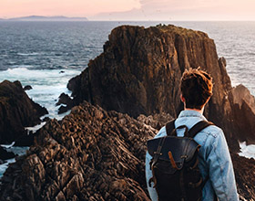
This trek will be harder than that of the previous days. The trail will lead you through a well-defined pathway towards Ranthan Top, Sudhamkhan Pass and Nanda Kund. The ascent rises steadily and the climb to Chophu Top can take around 15-25 minutes depending on your fitness level. The closer you get to Ranthan Top, the more breathtaking the mountain views become.
Reaching the summit is a wondrous experience. The Garhwal peaks extend to the left and the Kumaon ranges stretch to the right. The views of the valley, the Panchachuli ranges, Rajrambha and Meneka Peak are simply splendid.

Be cautious as you go down because there is a higher chance of slipping, especially if you’re moving at a quick pace. After reaching Thal Tok you will enter the forest to reach the third clearing from the right, which is Parava Thor.
Day 6: Parava Thor To Gogina

On the final day of your trek you will retrace your steps back to Gogina via Namik village. This stretch involves a steep descent to a suspension bridge that sways gently over a roaring river below. Once you’ve crossed the bridge, prepare for a strenuous climb back up to Gogina which will test your stamina and endurance.
The stunning views of the surrounding mountains and valleys make it all worth it. Take a moment to reflect on the unforgettable experiences you’ve had over the past five days and cherish the memories of this remarkable adventure.
Day 7: Gogina To Kathgodam

On your return journey from Gogina to Kathgodam Railway Station and beyond, stop at the local markets of Binsar, Almora and Nanital for refreshments and sightseeing activities.
Getting There
Kathgodam is the nearest railhead from where to begin the Ranthan Top trek. The closest airport is Pantnagar. Buses ply the 296km route between Delhi and Haldwani.
 Publish for free


 zpostcode
 Recruit
 weather
 mreligion
 Yellowpages
 sport
sport constellation
 shopping
 name
name game
game directory
 literature
 Word
Word tour
tour furnish
 Lottery
 tftnews
 lyrics
 News
News digital
 car
car dir
dir Edu
Edu Finance


